
“The tiny chirp from that monochrome Nokia when the network finally connected and you could check if tomorrow would be ‘sunny’ or ‘cloudy’ in pixelated icons.”
You remember staring at that ghostly green screen, waiting for the “Weather” service to load through WAP, right? One bar of signal. 2G. You paid per kilobyte. Your entire forecast was a single sun icon, maybe a cloud, and if you were lucky, a cartoon raindrop. Fast forward to the phone in your pocket now, and the same simple question, “Do I need an umbrella?” pulls in radar data, satellite feeds, machine learning models, crowd reports, and hyperlocal forecasts for the exact side of the street you are walking on.
The gulf between those two moments is where scary accurate weather apps live. We have gone from “Partly Cloudy” as an all-day mood to “rain starting in 7 minutes, heavy for 12, then tapering off.” That tiny chirp turned into live notifications that know your commute, your run, your kid’s soccer field, and your rooftop barbecue plans better than your old TV meteorologist ever could.
Weather apps stopped being cute little icons on the home screen and started acting like sensors tied into a mesh of satellites, Doppler radar, personal weather stations, and models that crunch terabytes of data per run. That feels normal now, but if you hold it next to those early 2000s WAP portals, it looks wild.
For a second, remember the physical feel of that first phone where you checked weather. Maybe it was a Nokia 3310, with that slightly rubbery plastic, heavier than it looked, with a screen that could barely show four lines of text. The back panel creaked a little when you squeezed it. The pixels were so chunky you could count them. Yet you still trusted that sad little “sun” icon to decide whether to hang your washing outside.
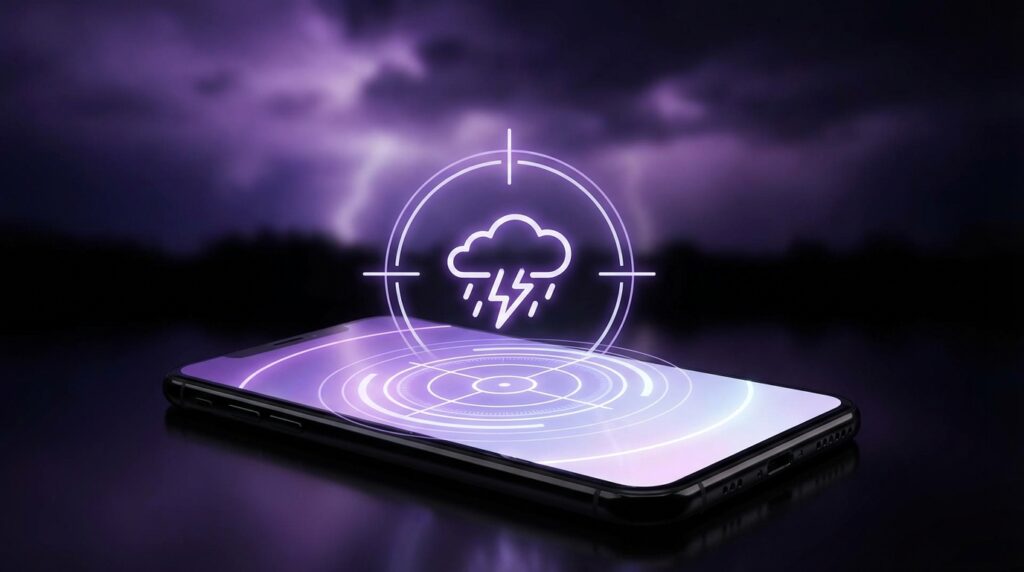
Compare that to the smooth, almost slippery glass slab in your hand now. You pinch and zoom on a live radar map, watching storms swirl in real time. You can see the hook echo of a severe cell, the boundary where warm and cool air meet, lightning strikes plotted like GPS points. You are not waiting for a TV break; the weather is just there, in motion, under your fingertips.
Maybe it is just nostalgia talking, but that contrast makes modern accuracy feel even sharper. Back then, 3-day forecasts were a kind of polite guess. Today, the best apps call out rain at your exact location down to a 5 to 15 minute window. They warn you about hail before you hear it hit the window. They flag air quality spikes before you smell smoke.
“User Review from 2005: ‘The forecast said sunny and it rained all afternoon. Weather on phones is useless lol.'”
The thing is, phones were not useless. The network and models were just young. The Global Forecast System, the European ECMWF runs, the Japanese and Canadian models, the HRRR high-resolution models, those were still growing into the data monsters they are now. Screen resolution and data speed were bottlenecks. A 128×128 display over GPRS could never show what an OLED at 120 Hz over 5G can.
Yet people still opened those early apps and operator portals with a weird kind of trust. Just a simple binary: do I take a jacket or not. The leap from that binary to our modern hyperlocal weather apps is the story behind “scary accurate” forecasts.
The gulf between T9 weather and hyperlocal radar
Let us ground this. Picture yourself in 2003, pressing those clicky T9 keys to open “Services” then “Weather.” The interaction felt slow but tactile. Each key had travel. There was feedback. The minuscule screen would show a text line like “15C Sun” with a bare icon. No wind direction, no feels-like, no hour-by-hour breakdown.
Data came from a single national or regional feed. Forecasts were coarse grids, often 20 to 50 km wide. If you lived near a boundary between coastal and inland conditions, or near hills, the generic “city” forecast would miss your actual experience by quite a bit.
Now? A modern weather app blends:
– Global and regional numerical weather prediction models
– High-resolution, rapid-refresh local models
– Doppler radar mosaics
– Satellites watching cloud tops and water vapor
– Thousands of personal weather stations on roofs and balconies
– Aircraft reports, buoys, and ground sensors
The grid size has shrunk. Temporal resolution has improved. A grid cell that used to cover half your county now might cover just a small neighborhood. Update cycles went from 6 to 12 hours down to 1 hour or even 15 minutes for certain models.
You tap a card in your app and see “Rain starting at 5:37 pm.” That timestamp is not a random guess. It is the output of algorithms watching advancing radar echoes, tracking their motion, intensity, and decay. They extrapolate along the vector of movement, cross-check with model output, and then slice it against your GPS coordinates. The app gives you a notification as that predicted edge of precipitation crosses an imaginary circle around your location.
Maybe it does not hit 5:37 on the dot. Maybe it is 5:34 or 5:41. The point is, the system is trying to forecast not just “today: rain” but “this block, this hour.” That granularity is the part that feels so eerie.
Retro specs vs scary accurate slabs
You can really feel the difference when you line up a classic phone with your current one.
| Then | Now |
|---|---|
| Nokia 3310 (circa early 2000s) | iPhone 17 (hypothetical current flagship) |
| 84 x 48 pixel monochrome display | ~2796 x 1290 pixel OLED, high refresh |
| GSM / 2G data, WAP browser | 5G / Wi‑Fi 6E, high-bandwidth data streams |
| No GPS. Location based on manual city selection or cell ID | Full GPS, GLONASS, Galileo, plus Wi‑Fi and cell triangulation |
| Weather: text + one icon, daily summary only | Weather: live radar, hyperlocal minute-by-minute forecast, AQI, UV, pollen |
| No background notifications | Push alerts for rain, lightning, severe alerts, storm tracks |
Those retro specs meant your weather app was half-blind. No GPS meant you picked a city and hoped the forecast matched your neighborhood. Limited data speed meant dense maps were out of the question. The app might have been nothing more than a skinned feed from a single provider.
Your current phone can handle radar tiles, animated overlays, and repeated updates without breaking a sweat. The CPU crunches map projection transforms, animation, and interpolation while throwing notifications in your face as soon as any model or radar source changes.
“Retro Specs: ‘Color display: 128×160 pixels. Java weather app: 78 KB JAR file. GPRS data: 40 kbps on a good day.'”
That shift in raw capability is the foundation for scary accurate apps. Without GPS, they cannot be precise about “your” location. Without radar overlays, they cannot show the actual approaching cell. Without fast updates, they cannot catch sudden storm growth. The device hardware is as much part of the story as the meteorology.
What “scary accurate” really means in practice
Accuracy is not just about getting today’s high temperature right. When people talk about a weather app feeling scary accurate, they often mean:
– Rain-onset timing: “It pinged me 10 minutes before it started pouring, and it hit almost exactly.”
– Local variability: “It said it would rain on the east side of town only, and my west side stayed dry.”
– Micro windows: “It told me I had a 45-minute dry window to walk the dog, and that was spot on.”
– Rare events: “It flagged a risk of hail in my specific suburb, and hail did hit, while the next suburb was fine.”
Under the hood, that comes from three key layers:
1. High-resolution models and ensembles
Early forecasts leaned heavily on a small number of global models with coarse resolution. Think 25 km or worse. Modern apps lean on:
– High-resolution regional models that go down to 3 km or even 1 km grids
– Rapid-refresh systems that update hourly or faster
– Ensemble runs: dozens of model variations that show a spread of possible outcomes
The app is essentially betting where the spread is tight. If 18 out of 20 ensemble members hit your location with a shower at 4 pm, the app leans into that timing and raises probability. If the spread is wide, a good app will temper precision and avoid promising minute-level accuracy.
2. Radar nowcasting
Radar is the short-term superpower. A line of thunderstorms on radar behaves like a moving object. It grows, decays, speeds up, slows down, and sometimes splits. Nowcasting algorithms treat these radar echoes like trackable entities. They:
– Identify the shapes
– Track their motion over consecutive frames
– Project their paths forward over the next 30 to 120 minutes
– Cross-match projected paths with your latitude and longitude
That is where “rain starting in 9 minutes” comes from. It is a projection from real observed rain, not just model speculation. When you see that timing in the app, you are seeing forecast plus real-time observation.
3. Sensor fusion and crowd signals
Modern phones carry:
– Barometer
– GPS
– Accelerometer
– Network connections for crowd reports
Some platforms ingest anonymized pressure readings from millions of phones. That gives them a denser pressure field than official weather stations alone. Barometric pressure influences model adjustments. It helps refine the current state of the atmosphere before the model runs forward.
Crowd reports (“Rain starting here,” “Hail in this area,” “Storm ended”) give quick feedback on what is actually happening at the ground, faster than official gauges can always confirm. When an app shows a rain notification and then gets a wave of “yes, raining” taps, it can update local maps and refine near-term probabilities.
Maybe it feels creepy that your phone can sense pressure changes and tie them to your latitude. Maybe that is just the sci-fi brain kicking in. But from a forecasting standpoint, that sensor mesh makes tiny error reductions that add up.
Why some weather apps feel more “on point” than others
Two phones, same location, open two different apps. One nails the timing of a storm. The other misses by hours. It feels like magic vs guesswork. Underneath, it usually comes down to:
– Data sources
– Update frequency
– Post-processing smarts
– How they treat your exact location
Some apps rely on a single model or a single national provider. Others blend multiple sources and run their own interpretation layers. A blend might look like:
– Use ECMWF for large-scale pattern
– Use HRRR for the next 12 hours locally
– Layer radar nowcasting on top for the next 60 minutes
– Pull in satellite for cloud movement where radar is sparse
– Adjust with station and crowd observations
If you notice an app that often feels “scary accurate,” you are probably seeing one that:
– Refreshes frequently
– Uses multiple models and ensembles, not just one
– Runs its own algorithms, not just passing through raw data
– Treats your location as a dynamic shape, not a single static point
Location matters here. When you grant high-precision location permissions, the app can distinguish between “city center” and “suburb near the hill that generates its own storms.” Less privacy, more precision. That tradeoff is always there.
From ringtones to real-time alerts
There is also a user experience shift that pushed weather apps from novelty toward core tool.
Remember custom ringtones? You would set a rain sound or thunderclap as a message tone, because it felt cool. Weather was an aesthetic thing: live wallpapers with raindrops, sun rays on the lock screen. Those were mostly cosmetic. The underlying forecast did not change much.
Today, weather is wired into:
– Commute planning: apps that reroute if severe storms are along your path
– Health: air quality affecting asthma, pollen counts affecting allergies
– Energy: solar panel output, heating, and cooling loads
– Outdoor sports: sailing, paragliding, running, cycling
Scary accurate apps latch on here because they cross a mental line: they stop being “nice to know” and start being “I actually rely on this.”
You go for a run because your app shows a two-hour gap between showers. The sky looks gray, you feel doubtful, but the last ten times it was right. The rain holds off. Your trust deepens. That feedback loop, repeated day after day, is where the “scary” vibe comes from. It is not just one perfect call. It is a series of almost eerie hits.
“User Review from 2005: ‘My carrier’s weather page says 20°C and clear. I am standing in a thunderstorm. 1 star.'”
That review sounds funny now, but it reflects how crude location and update cycles were. A single observation station for a whole region cannot describe a local storm bursting over one neighborhood.
Now we have:
– Gridded radar reflections updated every 2 to 10 minutes
– Hourly or sub-hourly model refreshes
– City-level and sub-city-level sensors reporting in real time
The device in your pocket is just the lens. The real engine is that dense web of data.
Different types of scary accurate apps
Not every “best weather app” is chasing the same kind of accuracy. They lean into different strengths.
Hyperlocal minute-by-minute apps
These focus on:
– Rain start/stop timing
– Short-term intensity
– Precise street-level cells
They often use:
– Nowcasting based on radar
– Blended models for the next few hours
– Machine learning for pattern recognition
You will see:
– “Rain starting at 3:22 pm”
– “Light rain ending in 11 minutes”
– Tight notifications that mostly cover the next 2 hours
Their limitation: once you go past about 2 to 3 hours, they hand off more to models and lose that razor edge.
Model-heavy apps with long-range skill
These emphasize:
– 7 to 14 day patterns
– Temperature trends
– Storm systems and fronts on a larger scale
They leverage:
– Global models and ensembles
– Pattern recognition for blocking highs, troughs, etc.
– Bias correction over years of archive data
You might see:
– “Confidence high for heat wave next week”
– “Increased risk of heavy rain around next Thursday”
They feel scary accurate when they call a big pattern shift days in advance, like a late-season snow after a warm spell, and it actually hits.
Specialist apps: storm chasers and nerd gear
These go deep into:
– Radar products like velocity and reflectivity
– Storm tracks with hail and rotation estimates
– Lightning density and strike proximities
For most people, these feel overkill. For storm chasers and outdoor event planners, they are gold. Accuracy here means calling out hail core paths, rotation regions, or microbursts with better detail than generic apps.
When someone posts, “My storm app said large hail in 8 minutes, and the sky went green, then it hammered the roof,” that is the type of accuracy that sticks in memory.
How your phone quietly feeds the forecast machine
We usually think of weather apps as one-way: data comes from the cloud, lands on your screen. That was true for your old flip phone: pure consumption. Modern phones leak small bits of data back, and that feedback improves forecasts.
Sensors your phone might share (depending on app and privacy settings):
– Pressure: barometer value, tied to rough location
– Location: anonymized positions, important during extreme events
– Usage: which forecast tiles users open, which alerts they act on
Pressure sensors are sneaky powerful. Imagine tens of thousands of phones across a city sending tiny pressure readings. A pressure fall sweeping across that city signals a front. Models use that to refine initialization: the starting state they evolve forward. Better start, better short-term output.
This is quiet, hidden. You never see a screen that says, “Thanks for your 1009.3 hPa reading.” You just notice your app nailing more small timing calls.
If you find that unnerving, that is fair. The tech story is very “sci-fi meets the mundane.” A slab of glass in your hand, reading pressure and whispering to servers, just so it can tell you that drizzle ends in 7 minutes. Maybe it is just nostalgia talking, but there was something simpler about those one-way, pixelated icons. You traded privacy for precision without a clear moment where you decided.
From static icons to animated truth
Think about how the visual language changed.
Early phones:
– Static icons: sun, cloud, raindrop
– Single number: “High: 23°C”
– Maybe a 3-day forecast in plain text
Modern apps:
– Animations based on vector radar tiles
– Color scales for intensity, from light blue drizzle to deep purple hail cores
– Wind barbs, direction arrows, isobars, and contour lines for temperature or pressure
– Layer toggles: radar, satellite, AQI, UV, smoke, pollen
That progression is not just eye candy. It is a more honest display of uncertainty and structure. A single “rain” icon hides the difference between scattered showers and a solid, slow-moving band. A live radar animation exposes gaps, edges, and motion.
You learn to “read” that. You see a thin broken line of showers and know that any given spot might dodge them. You see a thick shield of rain and know your entire region is in for a soaking. The app is giving you a way to think about probability visually, without calling it a statistics lesson.
The accuracy feels scary because you can validate it in real time. Look outside, look at the radar, match the motion. Your brain starts doing its own nowcasting using the same visuals the app has trained you on.
Where scary accurate breaks and why that matters
No weather app is perfect. Even the best ones fail. The danger in hype is that people over-trust and get blindsided. Good digital archivists of tech try to keep a bit of perspective.
Breakpoints for accuracy often show up when:
– Convective storms pop up in random spots where models show only a general risk
– Small-scale features like sea breezes or valley winds shift timing
– Data gaps exist in radar coverage or station networks
– Models blow the moisture feed, either overdoing or underdoing available humidity
In those cases:
– Minute-by-minute rain forecasts may show rain that never reaches your exact block
– A promised dry hour window gets clipped by a rogue cell
– Snow line estimates (rain vs snow) jump up or down 50 meters elevation during an event
If you have a memory of your app saying “light showers” and then you got walloped by a severe thunderstorm, that sticks more than 100 small wins. The thing that made the app feel magical the rest of the week suddenly feels fake.
From a tech perspective, that gap is where the next generation of “scary accurate” will push: finer convective modeling, better assimilation of radar and satellite, more creative use of surface observations.
From a human perspective, that is where experience blends with the app. You see CAPE values, instability markers, or just a certain look to the sky, and you hedge even when your main app tries to sound precise.
Why we keep chasing better forecasts on pocket screens
There is a nostalgia flavor to all of this. Having lived through:
– TV-only forecasts
– Teletext-style weather pages
– WAP portals with tiny icons
– Early smartphone apps with clunky radar
– Today’s rich, animated, hyperlocal services
You can trace a clear arc. Each step made the weather feel closer, more personal, more under your control. Yet the atmosphere is still chaotic. Sensible apps hint at uncertainty through probabilities and ranges. Sensible users treat “scary accurate” as “very good, but not perfect.”
The digital archive in your mind holds all these interfaces. The rubbery keypads. The ghost-light of monochrome screens. The first time a Java app slowly painted a crude radar blob over GPRS. The jump to capacitive touch, where you could slide storms across the map with a finger. The moment your wrist buzzed and your watch told you “rain in 10 minutes,” and then the first drops hit exactly on cue.
“User Review from 2005: ‘If my phone could tell me when rain starts in 5 minutes, I’d believe it’s magic. For now, it can’t even get tomorrow right.'”
Somewhere around the 4G era, we quietly crossed that line. The forecast on your phone for the next 60 minutes stopped being a guess and became a dynamic, data-rich nowcast. The magic arrived. It just arrived slowly enough that most people did not stop to mark the date.
That subtle shift is exactly what makes the best weather apps feel uncanny today. Not that they never miss, but that they hit so often, at such fine resolution, that your old memories of clunky, wrong-on-a-good-day forecasts feel like a different planet.
Maybe it is just nostalgia talking, but when that little buzz on your phone tells you “rain starting in 6 minutes,” and you glance out at dry pavement, there is still a split second where it feels like your device is cheating. Then the drops appear. And for a brief moment, you hear the phantom click of a T9 keypad somewhere in the back of your mind and remember when none of this was even imaginable on a screen that small.
